
Thank you for supporting this site ❤️
Make a donation
Make a donation
Gear up for your next adventure:
As an Amazon Associate, this site earns from qualifying purchases at no extra cost to you.
Stitten topographic map
Click on the map to display elevation.
Thank you for supporting this site ❤️
Make a donation
Make a donation
Gear up for your next adventure:
As an Amazon Associate, this site earns from qualifying purchases at no extra cost to you.
About this map
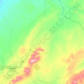
Name: Stitten topographic map, elevation, terrain.
Location: Stitten, daïra Boualem, El Bayadh, Algérie (33.59707 1.01633 34.06716 1.37703)
Average elevation: 4,314 ft
Minimum elevation: 3,556 ft
Maximum elevation: 6,572 ft
Thank you for supporting this site ❤️
Make a donation
Make a donation
Gear up for your next adventure:
As an Amazon Associate, this site earns from qualifying purchases at no extra cost to you.