
Thank you for supporting this site ❤️
Make a donation
Make a donation
Gear up for your next adventure:
As an Amazon Associate, this site earns from qualifying purchases at no extra cost to you.
Bala topographic map
Click on the map to display elevation.
Thank you for supporting this site ❤️
Make a donation
Make a donation
Gear up for your next adventure:
As an Amazon Associate, this site earns from qualifying purchases at no extra cost to you.
About this map
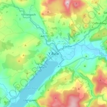
Name: Bala topographic map, elevation, terrain.
Location: Bala, Gwynedd, Wales, LL23 7UT, United Kingdom (52.87122 -3.63947 52.95122 -3.55947)
Average elevation: 896 ft
Minimum elevation: 512 ft
Maximum elevation: 1,795 ft
Thank you for supporting this site ❤️
Make a donation
Make a donation
Gear up for your next adventure:
As an Amazon Associate, this site earns from qualifying purchases at no extra cost to you.