
Thank you for supporting this site ❤️
Make a donation
Make a donation
Gear up for your next adventure:
As an Amazon Associate, this site earns from qualifying purchases at no extra cost to you.
Kirchmöser topographic map
Click on the map to display elevation.
Thank you for supporting this site ❤️
Make a donation
Make a donation
Gear up for your next adventure:
As an Amazon Associate, this site earns from qualifying purchases at no extra cost to you.
About this map
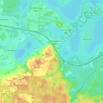
Name: Kirchmöser topographic map, elevation, terrain.
Location: Kirchmöser, Brandenburg an der Havel, Brandenburg, Germany (52.33853 12.39160 52.40065 12.47576)
Average elevation: 125 ft
Minimum elevation: 82 ft
Maximum elevation: 220 ft
Thank you for supporting this site ❤️
Make a donation
Make a donation
Gear up for your next adventure:
As an Amazon Associate, this site earns from qualifying purchases at no extra cost to you.