
Thank you for supporting this site ❤️
Make a donation
Make a donation
Gear up for your next adventure:
As an Amazon Associate, this site earns from qualifying purchases at no extra cost to you.
Cauris topographic map
Click on the map to display elevation.
Thank you for supporting this site ❤️
Make a donation
Make a donation
Gear up for your next adventure:
As an Amazon Associate, this site earns from qualifying purchases at no extra cost to you.
About this map
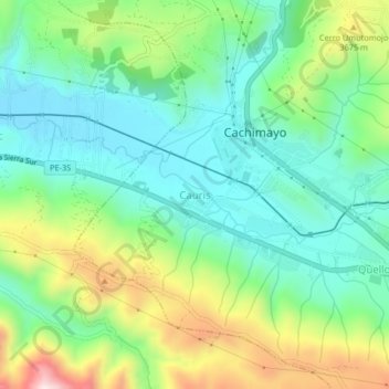
Name: Cauris topographic map, elevation, terrain.
Location: Cauris, Cachimayo, Anta, Cusco, Perú (-13.50214 -72.09586 -13.46214 -72.05586)
Average elevation: 11,621 ft
Minimum elevation: 11,119 ft
Maximum elevation: 12,700 ft
Thank you for supporting this site ❤️
Make a donation
Make a donation
Gear up for your next adventure:
As an Amazon Associate, this site earns from qualifying purchases at no extra cost to you.