
Make a donation
Gear up for your next adventure:
As an Amazon Associate, this site earns from qualifying purchases at no extra cost to you.
Mund topographic map
Click on the map to display elevation.
Make a donation
Gear up for your next adventure:
As an Amazon Associate, this site earns from qualifying purchases at no extra cost to you.
Mund
The former municipality is located in the Brig district, on the northern slope of the Rhone valley at an elevation of about 1,200 m (3,900 ft).
Make a donation
Gear up for your next adventure:
As an Amazon Associate, this site earns from qualifying purchases at no extra cost to you.
About this map
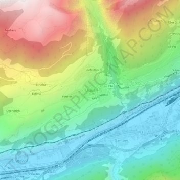
Name: Mund topographic map, elevation, terrain.
Location: Mund, Naters, Brig, Wallis, 3903, Switzerland (46.29529 7.92110 46.33529 7.96110)
Average elevation: 4,101 ft
Minimum elevation: 2,133 ft
Maximum elevation: 7,720 ft
Make a donation
Gear up for your next adventure:
As an Amazon Associate, this site earns from qualifying purchases at no extra cost to you.
Other topographic maps
Click on a map to view its topography, its elevation and its terrain.