Geolocate

Cicengo topographic map

Click on the map to display elevation.

About this map

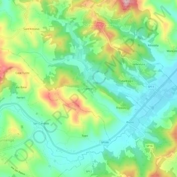
Name: Cicengo topographic map, elevation, terrain.

Location: Cicengo, Odalengo Grande, Alessandria, Piemonte, Italia (45.07543 8.14392 45.11543 8.18392)

Average elevation: 869 ft

Minimum elevation: 610 ft

Maximum elevation: 1,368 ft

Gear up for your next adventure:

🚪Portable Camp Chair - Foldable chair for comfort at camp
🧭Map Reading Tools - Tools and kits for map navigation
🔋Rechargeable Batteries - Power up your outdoor devices
🔌USB Car Charger - Car charger for on‑the‑go power needs
🔦Compact Flashlight - Reliable flashlight for emergencies

As an Amazon Associate, this site earns from qualifying purchases at no extra cost to you.