
容桂街道 topographic map
Interactive map
Click on the map to display elevation.
About this map
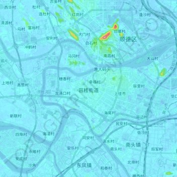
Name: 容桂街道 topographic map, elevation, terrain.
Location: 容桂街道, 顺德区, 佛山市, 广东省, 中国 (22.72803 113.20461 22.80565 113.35981)
Average elevation: 13 ft
Minimum elevation: -36 ft
Maximum elevation: 512 ft
Other topographic maps
Click on a map to view its topography, its elevation and its terrain.