
Make a donation
Gear up for your next adventure:
As an Amazon Associate, this site earns from qualifying purchases at no extra cost to you.
Brampton Township topographic map
Click on the map to display elevation.
Make a donation
Gear up for your next adventure:
As an Amazon Associate, this site earns from qualifying purchases at no extra cost to you.
About this map
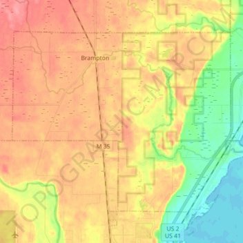
Name: Brampton Township topographic map, elevation, terrain.
Location: Brampton Township, Delta County, Michigan, United States (45.86944 -87.11904 45.94197 -86.97905)
Average elevation: 705 ft
Minimum elevation: 574 ft
Maximum elevation: 804 ft
Make a donation
Gear up for your next adventure:
As an Amazon Associate, this site earns from qualifying purchases at no extra cost to you.
Other topographic maps
Click on a map to view its topography, its elevation and its terrain.
Saint Martin Island
United States > Michigan > Delta County > Fairbanks Township
Average elevation: 591 ft
Make a donation
Gear up for your next adventure:
As an Amazon Associate, this site earns from qualifying purchases at no extra cost to you.