Geolocate

Mountain Home topographic map

Click on the map to display elevation.

About this map

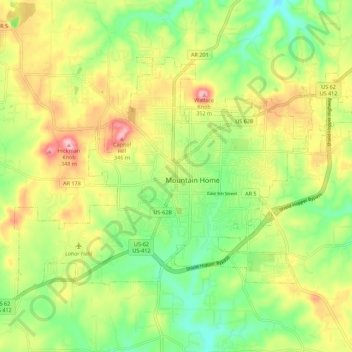
Name: Mountain Home topographic map, elevation, terrain.

Location: Mountain Home, Baxter County, Arkansas, 72653, USA (36.30688 -92.43621 36.36732 -92.32550)

Average elevation: 833 ft

Minimum elevation: 597 ft

Maximum elevation: 1,142 ft

Gear up for your next adventure:

🚗GPS Dash Cams - Record your scenic drives through mountain passes and canyons
Backpacking Tents - Weight-optimized shelters for multi-day topographic surveys
🔭Telescopic Hiking Pole - Adjustable pole for hiking stability
🦺Reflective Outdoor Gear - Safety gear for low‑light conditions
🧭GPS Watch Accessories - Bands and chargers for GPS watches

As an Amazon Associate, this site earns from qualifying purchases at no extra cost to you.