
Thank you for supporting this site ❤️
Make a donation
Make a donation
Gear up for your next adventure:
As an Amazon Associate, this site earns from qualifying purchases at no extra cost to you.
Lozaphohemi topographic map
Click on the map to display elevation.
Thank you for supporting this site ❤️
Make a donation
Make a donation
Gear up for your next adventure:
As an Amazon Associate, this site earns from qualifying purchases at no extra cost to you.
About this map
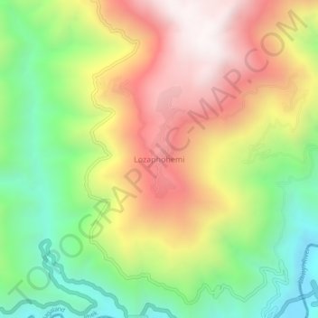
Name: Lozaphohemi topographic map, elevation, terrain.
Location: Lozaphohemi, Phek Sadar, Phek, Nagaland, India (25.61482 94.46644 25.65482 94.50644)
Average elevation: 4,035 ft
Minimum elevation: 2,208 ft
Maximum elevation: 6,073 ft
Thank you for supporting this site ❤️
Make a donation
Make a donation
Gear up for your next adventure:
As an Amazon Associate, this site earns from qualifying purchases at no extra cost to you.