Geolocate

Manukau topographic map

Click on the map to display elevation.

About this map

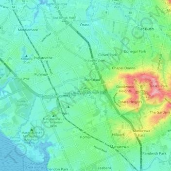
Name: Manukau topographic map, elevation, terrain.

Location: Manukau, Ōtara-Papatoetoe, Auckland, 2104, New Zealand (-37.03277 174.83745 -36.95277 174.91745)

Average elevation: 102 ft

Minimum elevation: 0 ft

Maximum elevation: 440 ft

Other topographic maps

Click on a map to view its topography, its elevation and its terrain.

Kohuora Park

New Zealand > Auckland > Ōtara-Papatoetoe

Average elevation: 69 ft

Gear up for your next adventure:

🦶Carbon Trekking Poles - Reduce knee impact on steep descents with ultra-light poles
☀️Outdoor Sunscreen - High protection sunscreen for outdoor activities
🪶Compact Camp Shovel - Folding shovel for campsite tasks
🔥Plasma Lighters - Windproof lighters that work in any weather condition
📷Action Camera - Capture your outdoor adventures in HD

As an Amazon Associate, this site earns from qualifying purchases at no extra cost to you.