
Thank you for supporting this site ❤️
Make a donation
Make a donation
Gear up for your next adventure:
As an Amazon Associate, this site earns from qualifying purchases at no extra cost to you.
Wyler topographic map
Click on the map to display elevation.
Thank you for supporting this site ❤️
Make a donation
Make a donation
Gear up for your next adventure:
As an Amazon Associate, this site earns from qualifying purchases at no extra cost to you.
About this map
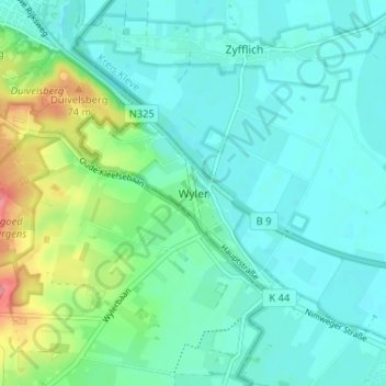
Name: Wyler topographic map, elevation, terrain.
Location: Wyler, Kranenburg, Kreis Kleve, Nordrhein-Westfalen, Deutschland (51.78852 5.94524 51.82852 5.98524)
Average elevation: 79 ft
Minimum elevation: 16 ft
Maximum elevation: 285 ft
Thank you for supporting this site ❤️
Make a donation
Make a donation
Gear up for your next adventure:
As an Amazon Associate, this site earns from qualifying purchases at no extra cost to you.