Geolocate

Minanga topographic map

Click on the map to display elevation.

About this map

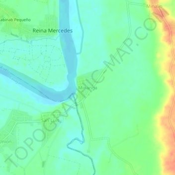
Name: Minanga topographic map, elevation, terrain.

Location: Minanga, Naguilian, Isabela, Cagayan Valley, Philippines (16.95198 121.81636 16.99198 121.85636)

Average elevation: 157 ft

Minimum elevation: 108 ft

Maximum elevation: 256 ft

Gear up for your next adventure:

🩳Quick‑Dry Hiking Shorts - Comfortable and quick‑dry shorts for summer hiking
🌲Outdoor Survival Books - Best books on survival skills
🛰️Handheld GPS Units - Professional satellite navigators for precise backcountry mapping
🎒Trail Energy Bars - High‑calorie bars for hiking energy
🥤Water Filter Bottle - All‑in‑one filter bottle for safe hydration

As an Amazon Associate, this site earns from qualifying purchases at no extra cost to you.