Geolocate

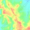
Earlington topographic map

Click on the map to display elevation.

About this map

Name: Earlington topographic map, elevation, terrain.

Location: Earlington, Hopkins County, Kentucky, 42410, United States (37.25733 -87.54454 37.28874 -87.48595)

Average elevation: 482 ft

Minimum elevation: 377 ft

Maximum elevation: 627 ft

Hopkins County trails, hiking, mountain biking, running and outdoor activities

Other topographic maps

Click on a map to view its topography, its elevation and its terrain.

Fies

United States > Kentucky > Hopkins County

Average elevation: 400 ft

Rabbit Ridge

United States > Kentucky > Hopkins County

Average elevation: 449 ft

Gear up for your next adventure:

🏥Hiking First Aid Kits - Comprehensive medical kits for remote trail injuries
🔥Camping Stove - Portable stove for camping and backcountry cooking
🧭Hiking Compass - Precision compass for reliable navigation in the wilderness
🥾Men's Hiking Boots - Durable, waterproof footwear for rugged terrain and steep inclines
👟Men's Trail Runners - Lightweight footwear for fast-paced exploration and light hiking

As an Amazon Associate, this site earns from qualifying purchases at no extra cost to you.