
Thank you for supporting this site ❤️
Make a donation
Make a donation
Gear up for your next adventure:
As an Amazon Associate, this site earns from qualifying purchases at no extra cost to you.
Valdivilla topographic map
Click on the map to display elevation.
Thank you for supporting this site ❤️
Make a donation
Make a donation
Gear up for your next adventure:
As an Amazon Associate, this site earns from qualifying purchases at no extra cost to you.
About this map
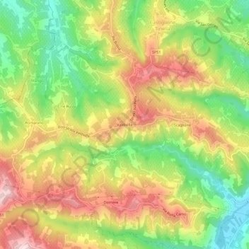
Name: Valdivilla topographic map, elevation, terrain.
Location: Valdivilla, Santo Stefano Belbo, Cuneo, Piemonte, 12053, Italia (44.68941 8.16156 44.72941 8.20156)
Average elevation: 1,158 ft
Minimum elevation: 600 ft
Maximum elevation: 1,736 ft
Thank you for supporting this site ❤️
Make a donation
Make a donation
Gear up for your next adventure:
As an Amazon Associate, this site earns from qualifying purchases at no extra cost to you.