Geolocate

El Verano topographic map

Click on the map to display elevation.

About this map

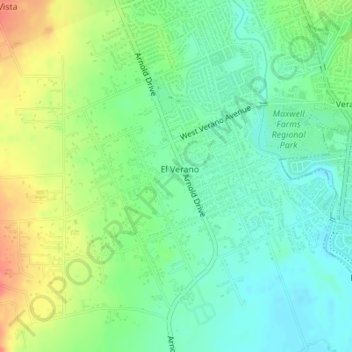
Name: El Verano topographic map, elevation, terrain.

Location: El Verano, Sonoma County, California, United States (38.28699 -122.50303 38.30729 -122.47637)

Average elevation: 131 ft

Minimum elevation: 66 ft

Maximum elevation: 236 ft

Sonoma County trails, hiking, mountain biking, running and outdoor activities

Gear up for your next adventure:

🪶Camp Gear Gift Set - Perfect gift bundle for outdoor fans
👟Men's Trail Runners - Lightweight footwear for fast-paced exploration and light hiking
🛠️Backpacking Tool Kit - Essential toolkit for outdoor repairs
🌡️Handheld Weather Meters - Measure wind, temp, and pressure for safe mountain travel
🎒Waterproof Dry Bags - Keep your electronics and maps dry inside your pack

As an Amazon Associate, this site earns from qualifying purchases at no extra cost to you.