Geolocate

Chiusure topographic map

Click on the map to display elevation.

About this map

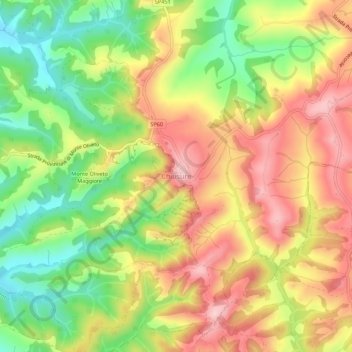
Name: Chiusure topographic map, elevation, terrain.

Location: Chiusure, Asciano, Siena, Tuscany, Italy (43.15596 11.53816 43.19596 11.57816)

Average elevation: 932 ft

Minimum elevation: 564 ft

Maximum elevation: 1,283 ft

Other topographic maps

Click on a map to view its topography, its elevation and its terrain.

Siena

Italy > Tuscany > Siena

Average elevation: 823 ft

Radda in Chianti

Italy > Tuscany > Siena

Average elevation: 1,588 ft

Asciano

Italy > Tuscany > Siena

Average elevation: 935 ft

Castiglione d'Orcia

Italy > Tuscany > Siena

Average elevation: 1,549 ft

San Quirico d'Orcia

Italy > Tuscany > Siena

Average elevation: 1,043 ft

Colle di Val d'Elsa

Italy > Tuscany > Siena

Average elevation: 820 ft

San Casciano dei Bagni

Italy > Tuscany > Siena

Average elevation: 1,552 ft

Unione dei Comuni Amiata Val d'Orcia

Italy > Tuscany > Siena

Average elevation: 1,680 ft

Chianciano Terme

Italy > Tuscany > Siena

Average elevation: 1,516 ft

Gaiole in Chianti

Italy > Tuscany > Siena

Average elevation: 1,421 ft

Gear up for your next adventure:

🛰️Handheld GPS Units - Professional satellite navigators for precise backcountry mapping
🪶Camp Gear Gift Set - Perfect gift bundle for outdoor fans
👓Polarized Sunglasses - Outdoor sunglasses for glare reduction
🚗GPS Dash Cams - Record your scenic drives through mountain passes and canyons
🛡️Bear Spray Outdoor - Protection in bear country hikes

As an Amazon Associate, this site earns from qualifying purchases at no extra cost to you.