
Thank you for supporting this site ❤️
Make a donation
Make a donation
Gear up for your next adventure:
As an Amazon Associate, this site earns from qualifying purchases at no extra cost to you.
Tuliman topographic map
Click on the map to display elevation.
Thank you for supporting this site ❤️
Make a donation
Make a donation
Gear up for your next adventure:
As an Amazon Associate, this site earns from qualifying purchases at no extra cost to you.
About this map
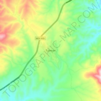
Name: Tuliman topographic map, elevation, terrain.
Location: Tuliman, Huitzuco de los Figueroa, Guerrero, 40150, México (17.98907 -99.29618 18.06907 -99.21618)
Average elevation: 3,593 ft
Minimum elevation: 2,881 ft
Maximum elevation: 4,911 ft
Thank you for supporting this site ❤️
Make a donation
Make a donation
Gear up for your next adventure:
As an Amazon Associate, this site earns from qualifying purchases at no extra cost to you.