
Thank you for supporting this site ❤️
Make a donation
Make a donation
Gear up for your next adventure:
As an Amazon Associate, this site earns from qualifying purchases at no extra cost to you.
Kraftsdorf topographic map
Click on the map to display elevation.
Thank you for supporting this site ❤️
Make a donation
Make a donation
Gear up for your next adventure:
As an Amazon Associate, this site earns from qualifying purchases at no extra cost to you.
About this map
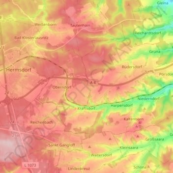
Name: Kraftsdorf topographic map, elevation, terrain.
Location: Kraftsdorf, Greiz, Thuringia, 07586, Germany (50.86071 11.87201 50.91584 12.02826)
Average elevation: 1,047 ft
Minimum elevation: 633 ft
Maximum elevation: 1,309 ft
Thank you for supporting this site ❤️
Make a donation
Make a donation
Gear up for your next adventure:
As an Amazon Associate, this site earns from qualifying purchases at no extra cost to you.