
Thank you for supporting this site ❤️
Make a donation
Make a donation
Gear up for your next adventure:
As an Amazon Associate, this site earns from qualifying purchases at no extra cost to you.
Lud topographic map
Click on the map to display elevation.
Thank you for supporting this site ❤️
Make a donation
Make a donation
Gear up for your next adventure:
As an Amazon Associate, this site earns from qualifying purchases at no extra cost to you.
About this map
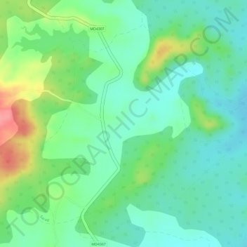
Name: Lud topographic map, elevation, terrain.
Location: Lud, Baihar Tahsil, Balaghat, Madhya Pradesh, India (21.87442 80.47921 21.89633 80.50285)
Average elevation: 1,949 ft
Minimum elevation: 1,844 ft
Maximum elevation: 2,152 ft
Thank you for supporting this site ❤️
Make a donation
Make a donation
Gear up for your next adventure:
As an Amazon Associate, this site earns from qualifying purchases at no extra cost to you.