
Thank you for supporting this site ❤️
Make a donation
Make a donation
Gear up for your next adventure:
As an Amazon Associate, this site earns from qualifying purchases at no extra cost to you.
Tajerouine topographic map
Click on the map to display elevation.
Thank you for supporting this site ❤️
Make a donation
Make a donation
Gear up for your next adventure:
As an Amazon Associate, this site earns from qualifying purchases at no extra cost to you.
About this map
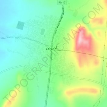
Name: Tajerouine topographic map, elevation, terrain.
Location: Tajerouine, تاجروين الشمالية, معتمدية تاجروين, Al Kaf, Tunisia (35.87966 8.53924 35.90005 8.56064)
Average elevation: 2,208 ft
Minimum elevation: 1,969 ft
Maximum elevation: 2,661 ft
Thank you for supporting this site ❤️
Make a donation
Make a donation
Gear up for your next adventure:
As an Amazon Associate, this site earns from qualifying purchases at no extra cost to you.