Geolocate

Geneva topographic map

Click on the map to display elevation.

About this map

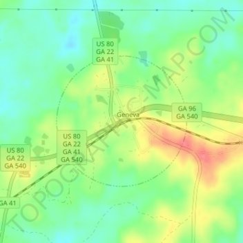
Name: Geneva topographic map, elevation, terrain.

Location: Geneva, Talbot County, Georgia, 31810, United States (32.57185 -84.56022 32.58637 -84.54303)

Average elevation: 538 ft

Minimum elevation: 446 ft

Maximum elevation: 673 ft

Talbot County trails, hiking, mountain biking, running and outdoor activities

Other topographic maps

Click on a map to view its topography, its elevation and its terrain.

Sprewell Bluff

United States > Georgia > Talbot County

Average elevation: 676 ft

Box Springs

United States > Georgia > Talbot County

Average elevation: 407 ft

Woodland

United States > Georgia > Talbot County

Average elevation: 758 ft

Junction City

United States > Georgia > Talbot County

Average elevation: 666 ft

Gear up for your next adventure:

🚗GPS Dash Cams - Record your scenic drives through mountain passes and canyons
👓Polarized Sunglasses - Outdoor sunglasses for glare reduction
🎒Gear Packing Cubes - Organize your backpack efficiently
🍳Camping Cook Set - Complete cookware for outdoor meals
💧Water Purification System - Clean water on the trail with reliable purifiers

As an Amazon Associate, this site earns from qualifying purchases at no extra cost to you.