Geolocate

Sottoguda topographic map

Click on the map to display elevation.

About this map

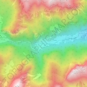
Name: Sottoguda topographic map, elevation, terrain.

Location: Sottoguda, Rocca Pietore, Belluno, Veneto, 32023, Italy (46.40499 11.91802 46.44499 11.95802)

Average elevation: 5,725 ft

Minimum elevation: 3,740 ft

Maximum elevation: 7,815 ft

Gear up for your next adventure:

🧯Emergency Survival Kit - All‑in‑one survival essentials for the backcountry
🧷Carabiner Set - Durable clips for gear attachment
🩳Quick‑Dry Hiking Shorts - Comfortable and quick‑dry shorts for summer hiking
📶Satellite Messenger - Communication device off‑grid
🎒Trekking Poles - Sturdy poles for balance and stability on rough terrain

As an Amazon Associate, this site earns from qualifying purchases at no extra cost to you.