Geolocate

Kishtwar topographic map

Click on the map to display elevation.

About this map
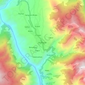
Name: Kishtwar topographic map, elevation, terrain.

Location: Kishtwar, Jammu and Kashmir, 182204, India (33.27079 75.72942 33.35079 75.80942)

Average elevation: 6,348 ft

Minimum elevation: 3,373 ft

Maximum elevation: 10,548 ft

Gear up for your next adventure:

🔋Rechargeable Batteries - Power up your outdoor devices
🩹Survival Bandages - High‑quality bandages for emergencies
🏔️Mountain Trail Maps - High‑detail maps for popular peaks
🪶Survival Guide Book - Expert advice for emergency preparedness
🧤Hiking Gloves - Protective gloves for rugged trails

As an Amazon Associate, this site earns from qualifying purchases at no extra cost to you.