
Thank you for supporting this site ❤️
Make a donation
Make a donation
Gear up for your next adventure:
As an Amazon Associate, this site earns from qualifying purchases at no extra cost to you.
Moranchel topographic map
Click on the map to display elevation.
Thank you for supporting this site ❤️
Make a donation
Make a donation
Gear up for your next adventure:
As an Amazon Associate, this site earns from qualifying purchases at no extra cost to you.
About this map
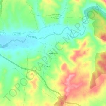
Name: Moranchel topographic map, elevation, terrain.
Location: Moranchel, Cifuentes, Guadalajara, Castilla-La Mancha, España (40.79760 -2.68762 40.83760 -2.64762)
Average elevation: 3,045 ft
Minimum elevation: 2,871 ft
Maximum elevation: 3,294 ft
Thank you for supporting this site ❤️
Make a donation
Make a donation
Gear up for your next adventure:
As an Amazon Associate, this site earns from qualifying purchases at no extra cost to you.