
Thank you for supporting this site ❤️
Make a donation
Make a donation
Gear up for your next adventure:
As an Amazon Associate, this site earns from qualifying purchases at no extra cost to you.
Yamanlar topographic map
Click on the map to display elevation.
Thank you for supporting this site ❤️
Make a donation
Make a donation
Gear up for your next adventure:
As an Amazon Associate, this site earns from qualifying purchases at no extra cost to you.
About this map
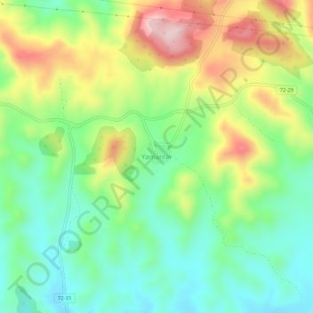
Name: Yamanlar topographic map, elevation, terrain.
Location: Yamanlar, Gercüş, Batman, Südostanatolien, Türkei (37.52715 41.44139 37.56715 41.48139)
Average elevation: 3,671 ft
Minimum elevation: 3,284 ft
Maximum elevation: 4,314 ft
Thank you for supporting this site ❤️
Make a donation
Make a donation
Gear up for your next adventure:
As an Amazon Associate, this site earns from qualifying purchases at no extra cost to you.