
Thank you for supporting this site ❤️
Make a donation
Make a donation
Gear up for your next adventure:
As an Amazon Associate, this site earns from qualifying purchases at no extra cost to you.
Sevoke topographic map
Click on the map to display elevation.
Thank you for supporting this site ❤️
Make a donation
Make a donation
Gear up for your next adventure:
As an Amazon Associate, this site earns from qualifying purchases at no extra cost to you.
About this map
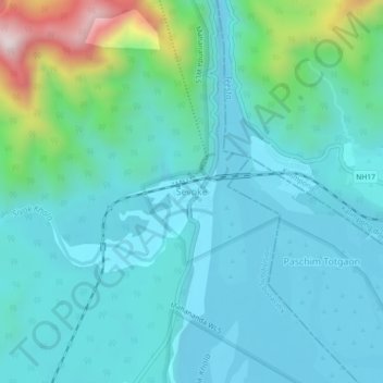
Name: Sevoke topographic map, elevation, terrain.
Location: Sevoke, Kurseong Subdivision, Darjeeling, West Bengal, India (26.85972 88.45080 26.89972 88.49080)
Average elevation: 833 ft
Minimum elevation: 427 ft
Maximum elevation: 2,743 ft
Thank you for supporting this site ❤️
Make a donation
Make a donation
Gear up for your next adventure:
As an Amazon Associate, this site earns from qualifying purchases at no extra cost to you.