
Thank you for supporting this site ❤️
Make a donation
Make a donation
Gear up for your next adventure:
As an Amazon Associate, this site earns from qualifying purchases at no extra cost to you.
Müolera topographic map
Click on the map to display elevation.
Thank you for supporting this site ❤️
Make a donation
Make a donation
Gear up for your next adventure:
As an Amazon Associate, this site earns from qualifying purchases at no extra cost to you.
About this map
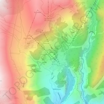
Name: Müolera topographic map, elevation, terrain.
Location: Müolera, Blatten b. Naters, Naters, Brig, Wallis, 3914, Schweiz (46.34335 7.95992 46.38335 7.99992)
Average elevation: 5,807 ft
Minimum elevation: 3,428 ft
Maximum elevation: 8,245 ft
Thank you for supporting this site ❤️
Make a donation
Make a donation
Gear up for your next adventure:
As an Amazon Associate, this site earns from qualifying purchases at no extra cost to you.