
Thank you for supporting this site ❤️
Make a donation
Make a donation
Gear up for your next adventure:
As an Amazon Associate, this site earns from qualifying purchases at no extra cost to you.
Salutio topographic map
Click on the map to display elevation.
Thank you for supporting this site ❤️
Make a donation
Make a donation
Gear up for your next adventure:
As an Amazon Associate, this site earns from qualifying purchases at no extra cost to you.
About this map
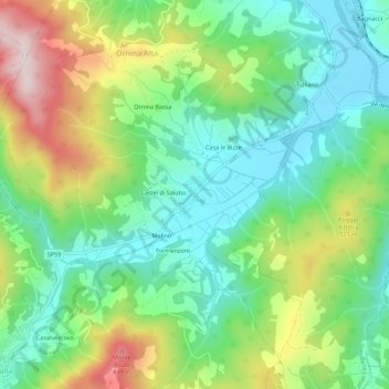
Name: Salutio topographic map, elevation, terrain.
Location: Salutio, Castel Focognano, Arezzo, Toscana, 52016, Italia (43.59965 11.79514 43.63965 11.83514)
Average elevation: 1,394 ft
Minimum elevation: 945 ft
Maximum elevation: 2,241 ft
Thank you for supporting this site ❤️
Make a donation
Make a donation
Gear up for your next adventure:
As an Amazon Associate, this site earns from qualifying purchases at no extra cost to you.