Geolocate

Mulshi topographic map

Click on the map to display elevation.

About this map

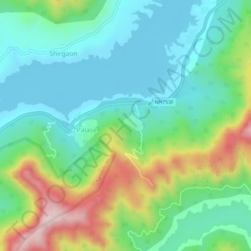
Name: Mulshi topographic map, elevation, terrain.

Location: Mulshi, Pune, Maharashtra, India (18.45820 73.47700 18.49820 73.51700)

Average elevation: 2,441 ft

Minimum elevation: 1,962 ft

Maximum elevation: 3,589 ft

Gear up for your next adventure:

🛰️Satellite Messengers - Emergency SOS and two-way messaging for off-grid adventures
🛌Ultralight Sleeping Bags - Compact down bags for cold nights in the wilderness
😴Insulated Sleeping Pads - Compact and warm pads for high-elevation camping
🚗GPS Dash Cams - Record your scenic drives through mountain passes and canyons
🪶LED Camping Lantern - Bright lantern for camp lighting

As an Amazon Associate, this site earns from qualifying purchases at no extra cost to you.