
Thank you for supporting this site ❤️
Make a donation
Make a donation
Gear up for your next adventure:
As an Amazon Associate, this site earns from qualifying purchases at no extra cost to you.
Camaragibe topographic map
Click on the map to display elevation.
Thank you for supporting this site ❤️
Make a donation
Make a donation
Gear up for your next adventure:
As an Amazon Associate, this site earns from qualifying purchases at no extra cost to you.
About this map
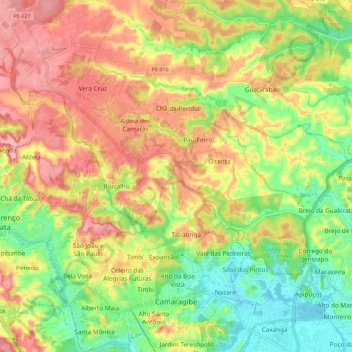
Name: Camaragibe topographic map, elevation, terrain.
Average elevation: 236 ft
Minimum elevation: 7 ft
Maximum elevation: 466 ft
Thank you for supporting this site ❤️
Make a donation
Make a donation
Gear up for your next adventure:
As an Amazon Associate, this site earns from qualifying purchases at no extra cost to you.
Other topographic maps
Click on a map to view its topography, its elevation and its terrain.
Praça Farias Neves
Brazil > Pernambuco > Região Metropolitana do Recife > Recife
Average elevation: 72 ft
Ana de Alburquerque
Brazil > Pernambuco > Região Metropolitana do Recife > Igarassu
Average elevation: 56 ft