Geolocate

Hidalgo topographic map

Click on the map to display elevation.

About this map

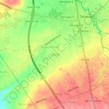
Name: Hidalgo topographic map, elevation, terrain.

Location: Hidalgo, Tanauan, Batangas, Calabarzon, 4232, Philippines (14.05046 121.12113 14.09046 121.16113)

Average elevation: 538 ft

Minimum elevation: 364 ft

Maximum elevation: 663 ft

Other topographic maps

Click on a map to view its topography, its elevation and its terrain.

Maria Paz

Philippines > Batangas > Tanauan

Average elevation: 210 ft

Barangay 3

Philippines > Batangas > Tanauan > Hidalgo

Average elevation: 518 ft

Barangay 5

Philippines > Batangas > Tanauan > Hidalgo

Average elevation: 505 ft

Suplang

Philippines > Batangas > Tanauan

Average elevation: 810 ft

Barangay 5

Philippines > Batangas > Tanauan > Hidalgo

Average elevation: 505 ft

Gear up for your next adventure:

🪶Camping Sleeping Pad - Comfortable sleeping pad for backpacking
🍳Camping Cook Set - Complete cookware for outdoor meals
🏫Relief Map Kits - Hands-on tools for teaching landforms and elevation
🔋Solar Power Banks - Keep your GPS and phone charged in remote wilderness areas
🦺Reflective Outdoor Gear - Safety gear for low‑light conditions

As an Amazon Associate, this site earns from qualifying purchases at no extra cost to you.