
Thank you for supporting this site ❤️
Make a donation
Make a donation
Gear up for your next adventure:
As an Amazon Associate, this site earns from qualifying purchases at no extra cost to you.
Paraggi topographic map
Click on the map to display elevation.
Thank you for supporting this site ❤️
Make a donation
Make a donation
Gear up for your next adventure:
As an Amazon Associate, this site earns from qualifying purchases at no extra cost to you.
About this map
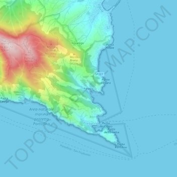
Name: Paraggi topographic map, elevation, terrain.
Location: Paraggi, Santa Margherita Ligure, Genoa, Liguria, 16038, Italy (44.29157 9.18860 44.33157 9.22860)
Average elevation: 236 ft
Minimum elevation: -3 ft
Maximum elevation: 1,604 ft
Thank you for supporting this site ❤️
Make a donation
Make a donation
Gear up for your next adventure:
As an Amazon Associate, this site earns from qualifying purchases at no extra cost to you.