
Cottage Grove topographic map
Click on the map to display elevation.
About this map
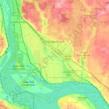
Name: Cottage Grove topographic map, elevation, terrain.
Average elevation: 817 ft
Minimum elevation: 633 ft
Maximum elevation: 1,050 ft
Washington County trails, hiking, mountain biking, running and outdoor activities
Other topographic maps
Click on a map to view its topography, its elevation and its terrain.
Grey Cloud Island
United States > Minnesota > Washington County > Grey Cloud Island Township
Average elevation: 738 ft
St. Croix River Boom Site Landing
United States > Minnesota > Washington County > Stillwater Township
Average elevation: 830 ft
Twin Pine Mobile Home Park
United States > Minnesota > Washington County > Hugo
Average elevation: 925 ft