
Thank you for supporting this site ❤️
Make a donation
Make a donation
Gear up for your next adventure:
As an Amazon Associate, this site earns from qualifying purchases at no extra cost to you.
Rhode topographic map
Click on the map to display elevation.
Thank you for supporting this site ❤️
Make a donation
Make a donation
Gear up for your next adventure:
As an Amazon Associate, this site earns from qualifying purchases at no extra cost to you.
About this map
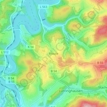
Name: Rhode topographic map, elevation, terrain.
Location: Rhode, Olpe, Kreis Olpe, Nordrhein-Westfalen, 57462, Deutschland (51.03058 7.84047 51.07058 7.88047)
Average elevation: 1,220 ft
Minimum elevation: 1,001 ft
Maximum elevation: 1,657 ft
Thank you for supporting this site ❤️
Make a donation
Make a donation
Gear up for your next adventure:
As an Amazon Associate, this site earns from qualifying purchases at no extra cost to you.