Geolocate

Bertolini topographic map

Click on the map to display elevation.

About this map

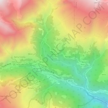
Name: Bertolini topographic map, elevation, terrain.

Location: Bertolini, Crissolo, Cuneo, Piedmont, Italy (44.68662 7.14032 44.72662 7.18032)

Average elevation: 5,531 ft

Minimum elevation: 3,340 ft

Maximum elevation: 7,933 ft

Gear up for your next adventure:

📶Vehicle Signal Boosters - Improve reception in rural areas while driving to trailheads
👓Polarized Sunglasses - Outdoor sunglasses for glare reduction
🏔️Mountain Trail Maps - High‑detail maps for popular peaks
🪶Trail Camera - Capture wildlife on your hikes
🚗GPS Dash Cams - Record your scenic drives through mountain passes and canyons

As an Amazon Associate, this site earns from qualifying purchases at no extra cost to you.