
Naraingarh topographic map
Click on the map to display elevation.
Naraingarh
Naraingarh is located near the foothills of the Sivalik range of the Himalayas in northwest India. It covers an area of approximately 481 km2. It shares its borders with the states of Himachal Pradesh. The exact cartographic co-ordinates of Narayangarh are 30°28′N 77°08′E / 30.47°N 77.13°E / 30.47; 77.13.It has an average elevation of 325 metres (1065 ft).
About this map
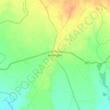
Name: Naraingarh topographic map, elevation, terrain.
Location: Naraingarh, Ambala, Haryana, 134203, India (30.43239 77.08427 30.51239 77.16427)
Average elevation: 1,053 ft
Minimum elevation: 1,001 ft
Maximum elevation: 1,122 ft