Geolocate

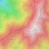
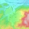
Fukuroi topographic map

Click on the map to display elevation.

About this map

Name: Fukuroi topographic map, elevation, terrain.

Location: Fukuroi, Shizuoka Prefecture, Chubu Region, Japan (34.51909 137.85125 34.82236 138.00967)

Average elevation: 62 ft

Minimum elevation: -13 ft

Maximum elevation: 863 ft

Other topographic maps

Click on a map to view its topography, its elevation and its terrain.
Osaka Prefecture

Japan

Average elevation: 617 ft

300M

Japan > Nagasaki

Average elevation: 722 ft

Takeda Castle

Japan > Asago

Average elevation: 571 ft

Akaishi Mountains

Japan > Oshika

Average elevation: 8,501 ft

Iwo to

Japan > Tokyo > Ogasawara

Average elevation: 0 ft

葭町

Japan > Matsumoto

Average elevation: 2,021 ft

Nishikigaoka-chuo Park

Japan > Sendai

Average elevation: 646 ft

Nakauonuma County

Japan

Average elevation: 1,985 ft

Mount Yatsugatake viewpoint

Japan > Suwa County > Fujimi

Average elevation: 5,715 ft

Gear up for your next adventure:

🪶Survival Guide Book - Expert advice for emergency preparedness
🔦Powerful Headlamps - Ultra-bright hands-free lighting for night navigation
📚Navigation Handbooks - Master the art of reading topographic maps and using a compass
🛠️Backpacking Tool Kit - Essential toolkit for outdoor repairs
🗺️NatGeo Topo Maps - High-quality waterproof printed topographic maps of US Parks

As an Amazon Associate, this site earns from qualifying purchases at no extra cost to you.