
Whitacre topographic map
Click on the map to display elevation.
About this map
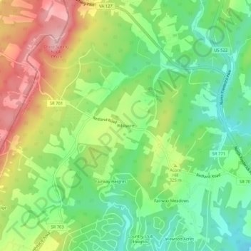
Name: Whitacre topographic map, elevation, terrain.
Location: Whitacre, Frederick County, Virginia, 22625, United States (39.31232 -78.34723 39.35232 -78.30723)
Average elevation: 994 ft
Minimum elevation: 764 ft
Maximum elevation: 1,312 ft
Frederick County trails, hiking, mountain biking, running and outdoor activities
Other topographic maps
Click on a map to view its topography, its elevation and its terrain.
Kernstown Battlefield Park
United States > Virginia > Frederick County > Winchester > Valley Acres
Average elevation: 791 ft