
Thank you for supporting this site ❤️
Make a donation
Make a donation
Gear up for your next adventure:
As an Amazon Associate, this site earns from qualifying purchases at no extra cost to you.
Balag topographic map
Click on the map to display elevation.
Thank you for supporting this site ❤️
Make a donation
Make a donation
Gear up for your next adventure:
As an Amazon Associate, this site earns from qualifying purchases at no extra cost to you.
About this map
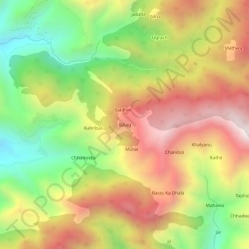
Name: Balag topographic map, elevation, terrain.
Location: Balag, Renuka, Sirmaur District, Himachal Pradesh, India (30.66641 77.48679 30.70641 77.52679)
Average elevation: 6,056 ft
Minimum elevation: 4,298 ft
Maximum elevation: 7,815 ft
Thank you for supporting this site ❤️
Make a donation
Make a donation
Gear up for your next adventure:
As an Amazon Associate, this site earns from qualifying purchases at no extra cost to you.