Geolocate

Reno topographic map

Click on the map to display elevation.

About this map

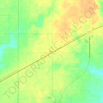
Name: Reno topographic map, elevation, terrain.

Location: Reno, Hendricks County, Indiana, 46121, United States (39.69032 -86.69028 39.73032 -86.65028)

Average elevation: 899 ft

Minimum elevation: 833 ft

Maximum elevation: 942 ft

Hendricks County trails, hiking, mountain biking, running and outdoor activities

Other topographic maps

Click on a map to view its topography, its elevation and its terrain.

North Salem

United States > Indiana > Hendricks County

Average elevation: 912 ft

Stilesville

United States > Indiana > Hendricks County

Average elevation: 787 ft

Coatesville

United States > Indiana > Hendricks County

Average elevation: 889 ft

Pittsboro

United States > Indiana > Hendricks County

Average elevation: 935 ft

Amo

United States > Indiana > Hendricks County

Average elevation: 837 ft

Avon

United States > Indiana > Hendricks County

Average elevation: 833 ft

Danville

United States > Indiana > Hendricks County

Average elevation: 922 ft

Clayton

United States > Indiana > Hendricks County

Average elevation: 863 ft

Lizton

United States > Indiana > Hendricks County

Average elevation: 958 ft

Gear up for your next adventure:

🧢Sun Protection Hats - Wide-brimmed and UPF-rated hats for high-altitude sun safety
📷Action Cameras - Rugged cameras to document your journeys across rugged terrain
🛡️Insect Repellent - Protection against bugs during outdoor activities
🎁Geography Themed Gifts - Unique gift ideas for map lovers and geography enthusiasts
🌎3D Topographic Globes - Raised relief globes for a tactile understanding of geography

As an Amazon Associate, this site earns from qualifying purchases at no extra cost to you.