Geolocate

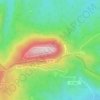
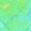
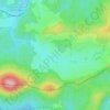
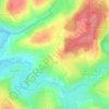
Lichtenberg topographic map

Click on the map to display elevation.

About this map

Name: Lichtenberg topographic map, elevation, terrain.

Location: Lichtenberg, Saverne, Bas-Rhin, European Collectivity of Alsace, Grand Est, Metropolitan France, 67340, France (48.89718 7.44524 48.95023 7.51305)

Average elevation: 915 ft

Minimum elevation: 627 ft

Maximum elevation: 1,332 ft

Other topographic maps

Click on a map to view its topography, its elevation and its terrain.

le Champ du Feu

France > Grand Est > Bas-Rhin > Belmont

Average elevation: 3,100 ft

Erstein-Gare

France > Grand Est > Bas-Rhin > Erstein

Average elevation: 505 ft

Col du Donon

France > Grand Est > Bas-Rhin > Grandfontaine

Average elevation: 2,277 ft

Graufthal

France > Grand Est > Bas-Rhin > Eschbourg

Average elevation: 951 ft

Willigen

France > Grand Est > Bas-Rhin > Kilstett

Average elevation: 427 ft

2te Gewann Neufeld

France > Grand Est > Bas-Rhin > Offendorf

Average elevation: 417 ft

Roed

France > Grand Est > Bas-Rhin > Wingersheim les Quatre Bans > Gingsheim

Average elevation: 748 ft

Grande Île

France > Grand Est > Bas-Rhin > Strasbourg

Average elevation: 476 ft

Le Hang

France > Grand Est > Bas-Rhin > Bourg-Bruche

Average elevation: 1,903 ft

Su

France > Grand Est > Bas-Rhin > Soultz-les-Bains

Average elevation: 679 ft

Tête Pelée

France > Grand Est > Bas-Rhin > La Broque

Average elevation: 2,205 ft

Kreutzel

France > Grand Est > Bas-Rhin > Baerendorf

Average elevation: 902 ft

Gear up for your next adventure:

📡GPS Antenna Upgrade - Enhance GPS reception in remote terrain
🪵Folding Camp Saw - Compact saw for wood and campsite work
⛺Backpacking Tents - Weight-optimized shelters for multi-day topographic surveys
🕶️Glacier Sunglasses - Side shields to protect eyes from high-altitude snow glare
😴Insulated Sleeping Pads - Compact and warm pads for high-elevation camping

As an Amazon Associate, this site earns from qualifying purchases at no extra cost to you.