Geolocate

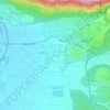
Oshrat topographic map

Click on the map to display elevation.

About this map

Name: Oshrat topographic map, elevation, terrain.

Location: Oshrat, Mate Asher Regional Council, Acre Subdistrict, North District, Israel (32.96913 35.15281 32.97466 35.16167)

Average elevation: 197 ft

Minimum elevation: 69 ft

Maximum elevation: 420 ft

Other topographic maps

Click on a map to view its topography, its elevation and its terrain.
Gear up for your next adventure:

🛏️Cold Weather Sleeping Bag - Warm sleeping bag for cold conditions
🧯Portable Fire Pit - Compact fire pit for camping spots
🎁Geography Themed Gifts - Unique gift ideas for map lovers and geography enthusiasts
🕶️GPS Smartphone Mount - Secure mount for phone navigation
📦Dry Bags Set - Waterproof storage for electronics and clothes

As an Amazon Associate, this site earns from qualifying purchases at no extra cost to you.