Geolocate

Neckargemünd topographic map

Click on the map to display elevation.

About this map
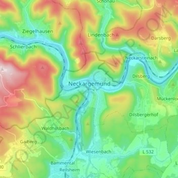
Name: Neckargemünd topographic map, elevation, terrain.

Location: Neckargemünd, GVV Neckargemünd, Rhein-Neckar-Kreis, Baden-Württemberg, 69151, Germany (49.36873 8.75472 49.41624 8.89119)

Average elevation: 810 ft

Minimum elevation: 348 ft

Maximum elevation: 1,578 ft

Other topographic maps

Click on a map to view its topography, its elevation and its terrain.

Gear up for your next adventure:

🧭Compass with Lanyard - Easy‑carry compass for navigation
📦Dry Bags Set - Waterproof storage for electronics and clothes
🥾Hiking Shoes - Durable and comfortable shoes for trail hiking
🧯Emergency Survival Kit - All‑in‑one survival essentials for the backcountry
🏫Relief Map Kits - Hands-on tools for teaching landforms and elevation

As an Amazon Associate, this site earns from qualifying purchases at no extra cost to you.