Geolocate

Brandywine topographic map

Click on the map to display elevation.

About this map
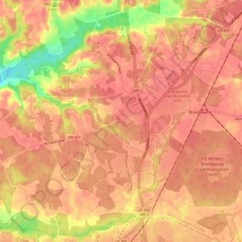
Name: Brandywine topographic map, elevation, terrain.

Location: Brandywine, Prince George's County, Maryland, 20613, United States (38.65156 -76.93929 38.73538 -76.82746)

Average elevation: 200 ft

Minimum elevation: 36 ft

Maximum elevation: 256 ft

Prince George's County trails, hiking, mountain biking, running and outdoor activities

Gear up for your next adventure:

⛑️Personal Locator Beacon - Safety beacon for emergencies
📱Solar Portable Charger - Solar power bank for charging devices off‑grid
🔋Solar Power Banks - Keep your GPS and phone charged in remote wilderness areas
😴Insulated Sleeping Pads - Compact and warm pads for high-elevation camping
📚USA Hiking Guide Books - Top trail guides and map books

As an Amazon Associate, this site earns from qualifying purchases at no extra cost to you.