Geolocate

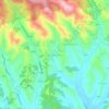
Bestovje topographic map

Click on the map to display elevation.

About this map

Name: Bestovje topographic map, elevation, terrain.

Location: Bestovje, Grad Sveta Nedelja, Zagreb County, 10437, Croatia (45.80004 15.80635 45.81576 15.83125)

Average elevation: 417 ft

Minimum elevation: 374 ft

Maximum elevation: 584 ft

Other topographic maps

Click on a map to view its topography, its elevation and its terrain.
Beder

Croatia > Zagreb County > Grad Samobor

Average elevation: 1,358 ft

Dubranec

Croatia > Zagreb County > City of Velika Gorica

Average elevation: 581 ft

Donja Drenova

Croatia > Zagreb County

Average elevation: 705 ft

Dubranec

Croatia > Zagreb County > City of Velika Gorica

Average elevation: 581 ft

Prigorje Brdovečko

Croatia > Zagreb County

Average elevation: 528 ft

Vernari

Croatia > Zagreb County > Gornji Stupnik

Average elevation: 423 ft

Trstenik

Croatia > Zagreb County

Average elevation: 656 ft

Gear up for your next adventure:

🔋Solar Power Banks - Keep your GPS and phone charged in remote wilderness areas
🪶Trail Camera - Capture wildlife on your hikes
🎁Geography Themed Gifts - Unique gift ideas for map lovers and geography enthusiasts
🥄Camping Utensil Set - Lightweight utensils for outdoor meals
🗺️Topographic Maps - Detailed topo maps for hiking, exploring and outdoor navigation

As an Amazon Associate, this site earns from qualifying purchases at no extra cost to you.