Geolocate

Mahesar topographic map

Click on the map to display elevation.

About this map

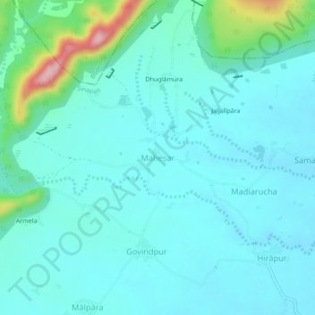
Name: Mahesar topographic map, elevation, terrain.

Location: Mahesar, Sinapali, Nuapada District, Odisha, India (20.13957 82.51786 20.17957 82.55786)

Average elevation: 991 ft

Minimum elevation: 879 ft

Maximum elevation: 1,558 ft

Gear up for your next adventure:

🪵Folding Camp Saw - Compact saw for wood and campsite work
🩳Quick‑Dry Hiking Shorts - Comfortable and quick‑dry shorts for summer hiking
🛰️Handheld GPS Units - Professional satellite navigators for precise backcountry mapping
🌡️Handheld Weather Meters - Measure wind, temp, and pressure for safe mountain travel
🕶️GPS Smartphone Mount - Secure mount for phone navigation

As an Amazon Associate, this site earns from qualifying purchases at no extra cost to you.