
Thank you for supporting this site ❤️
Make a donation
Make a donation
Gear up for your next adventure:
As an Amazon Associate, this site earns from qualifying purchases at no extra cost to you.
Dwaraka topographic map
Click on the map to display elevation.
Thank you for supporting this site ❤️
Make a donation
Make a donation
Gear up for your next adventure:
As an Amazon Associate, this site earns from qualifying purchases at no extra cost to you.
About this map
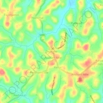
Name: Dwaraka topographic map, elevation, terrain.
Location: Dwaraka, Mananthavady, Wayanad, Kerala, 670732, India (11.73844 75.98630 11.77844 76.02630)
Average elevation: 2,448 ft
Minimum elevation: 2,343 ft
Maximum elevation: 2,566 ft
Thank you for supporting this site ❤️
Make a donation
Make a donation
Gear up for your next adventure:
As an Amazon Associate, this site earns from qualifying purchases at no extra cost to you.