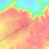
Jabalpur topographic map
Click on the map to display elevation.
About this map

Name: Jabalpur topographic map, elevation, terrain.
Average elevation: 1,339 ft
Minimum elevation: 1,099 ft
Maximum elevation: 1,870 ft
Other topographic maps
Click on a map to view its topography, its elevation and its terrain.
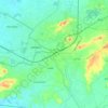
Jabalpur
India > Madhya Pradesh > Ranjhi Tahsil
The Narmada river bringing in freshwater from the Vindyachal Ranges has developed Jabalpur district into an agrarian economy. The land of the Narmada basin with its fertile alluvial soil gives good yields of sorghum, wheat, rice, and millet in the villages around Jabalpur. Important among commercial crops are…
Average elevation: 1,339 ft
Jabalpur
India > Madhya Pradesh > Ranjhi Tahsil
The Narmada river bringing in freshwater from the Vindyachal Ranges has developed Jabalpur district into an agrarian economy. The land of the Narmada basin with its fertile alluvial soil gives good yields of sorghum, wheat, rice, and millet in the villages around Jabalpur. Important among commercial crops are…
Average elevation: 1,339 ft