Geolocate

Cross Lanes topographic map

Click on the map to display elevation.

About this map

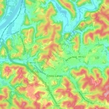
Name: Cross Lanes topographic map, elevation, terrain.

Location: Cross Lanes, Kanawha County, West Virginia, United States (38.41071 -81.81431 38.45575 -81.72986)

Average elevation: 768 ft

Minimum elevation: 551 ft

Maximum elevation: 1,086 ft

Kanawha County trails, hiking, mountain biking, running and outdoor activities

Gear up for your next adventure:

🥤Water Filter Bottle - All‑in‑one filter bottle for safe hydration
🧭Orienteering Set - Complete compass and map reading kit
🧢Sun Protection Hats - Wide-brimmed and UPF-rated hats for high-altitude sun safety
🗻Climbing Gear Basics - Essential gear for beginner climbers
🧺Microfiber Travel Towels - Compact and fast-drying towels for trail use

As an Amazon Associate, this site earns from qualifying purchases at no extra cost to you.